Two of the five pages currently ranking for Norway fjords map place the Sognefjord in a county that stopped existing on 1 January 2020. One of them lists Trollfjord’s nearest airport as Hammerfest, which is about 400 kilometres away in a different region entirely.
That is the state of the geography writing on this subject, and it matters more than it sounds, because the single most expensive mistake people make planning a Norway trip is misreading the map. Two fjords that look adjacent are often eight hours apart. A 60-kilometre gap can involve a ferry that runs twice a day. A mountain road that would halve your journey is closed until June.
So this is the orientation article: where the fjords actually are, which counties they sit in as of 2026, which airport serves which, north-to-south order so you can build a route, and — the part nobody covers — why map distance and travel time diverge so violently in this country.
The one-paragraph version
Norway’s classic fjords run down the west coast, roughly from Stavanger in the south to Åndalsnes in the north — about 500 kilometres of coastline containing perhaps 200 fjords. They sit in three counties: Rogaland in the south, Vestland in the middle, and Møre og Romsdal in the north. Bergen is the natural base for the middle, Stavanger for the south, Ålesund for the north. Everything east of the mountains, including Oslo, is a different Norway. Everything north of Trondheim is a third one.
The three fjord counties, correct for 2026
Norway has reorganised its counties twice in six years and most travel writing has not caught up. In 2020 the country went from 19 counties to 11; on 1 January 2024 several of those mergers were reversed and the count went back to 15.
Crucially, the three fjord counties were not affected by the 2024 reversal. They are:
| County | Main city | Fjords in it | Note |
|---|---|---|---|
| Rogaland | Stavanger | Lysefjord, Boknafjord, Ryfylke fjords | Unchanged throughout |
| Vestland | Bergen | Sognefjord, Nærøyfjord, Aurlandsfjord, Hardangerfjord, Nordfjord | Created 2020 by merging Hordaland and Sogn og Fjordane |
| Møre og Romsdal | Ålesund | Geirangerfjord, Storfjord, Hjørundfjord, Romsdalsfjord | Unchanged |
Sogn og Fjordane no longer exists. Neither does Hordaland. If a guide tells you the Sognefjord is in Sogn og Fjordane, it has not been updated in six years, and you should treat its opening dates and prices with the same suspicion.
North to south: the order nobody gives you
The most common orientation failure is not knowing whether Nordfjord is above or below Sognefjord. Here is the sequence, running from north to south along the coast.
| Order | Fjord system | County | Nearest town | Known for |
|---|---|---|---|---|
| 1 (north) | Romsdalsfjord | Møre og Romsdal | Åndalsnes | Trollstigen, Romsdalen, big walls |
| 2 | Storfjord & Geirangerfjord | Møre og Romsdal | Geiranger, Hellesylt | UNESCO, the Seven Sisters |
| 3 | Hjørundfjord | Møre og Romsdal | Sæbø | Steep, empty, Sunnmøre Alps |
| 4 | Nordfjord | Vestland | Stryn, Loen | Jostedalsbreen glacier, Loen Skylift |
| 5 | Sunnfjord | Vestland | Førde | Quiet, few visitors |
| 6 | Sognefjord (incl. Nærøyfjord, Aurlandsfjord) | Vestland | Flåm, Balestrand, Sogndal | Longest and deepest; UNESCO |
| 7 | Hardangerfjord | Vestland | Odda, Norheimsund, Rosendal | Orchards, Trolltunga, Vøringsfossen |
| 8 (south) | Lysefjord & Ryfylke | Rogaland | Stavanger | Preikestolen, Kjerag |
Bergen sits between 6 and 7, which is why it works as a base for both and for neither of the extremes. Ålesund sits at 2 and 3. Stavanger sits at 8.
Which airport for which fjord
No competitor publishes this table and it is the first thing you need when you are booking flights.
| Airport | Code | From Oslo | Serves |
|---|---|---|---|
| Bergen Flesland | BGO | ~55 min | Hardangerfjord, Sognefjord, Nærøyfjord, Flåm |
| Stavanger Sola | SVG | ~53 min | Lysefjord, Preikestolen, Kjerag |
| Ålesund Vigra | AES | Under an hour | Geirangerfjord, Hjørundfjord, Storfjord |
| Sogndal Haukåsen | SOG | ~50 min (Widerøe) | Inner Sognefjord, Lustrafjord, Jotunheimen |
| Molde Årø | MOL | Under an hour | Romsdalsfjord, Atlantic Road |
| Førde Bringeland | FDE | Under an hour | Sunnfjord, outer Sognefjord |
| Bodø | BOO | ~1 h 25 | Gateway to Lofoten by ferry or short hop |
| Tromsø | TOS | ~2 h | Lyngenfjord and Arctic fjords |
Only the Oslo–Bergen and Oslo–Stavanger times are firmly documented; the shorter Widerøe routes are all in the 45–60 minute band but I could not confirm each individually, so treat those as approximate. Bergen and Stavanger both have direct connections from several European cities, which the smaller airports mostly do not.
The underused one is Sogndal. A fifty-minute Widerøe hop from Oslo puts you in the middle of the Sognefjord — a place that takes most people two full days to reach overland. If your trip is short and the inner fjords are the point, it is the single biggest time saving available.
Why the map lies
This is the section the whole article exists for. Norwegian distances behave nothing like distances elsewhere, and there are four reasons.
1. Ferries are infrastructure, not scenery
The main coastal highway, the E39, runs about 1,100 kilometres from Kristiansand to Trondheim and crosses seven car ferries on the way. Total journey time is around 21 hours today; the long-running project to make the route ferry-free targets about 13. Individual crossings are short — twenty minutes on the Sognefjord at Lavik–Oppedal — but the waiting is not, and on a summer afternoon a full ferry leaves cars behind for the next sailing.
Any route planner that gives you a driving time without the ferry queue is understating by 20–40%.
2. Fjords are walls, and you drive around them
A fjord is a trench a kilometre deep and 200 kilometres long. You cannot cross it except by boat or by driving to its head. Two towns 15 kilometres apart across water can be 90 minutes apart by road.
3. The high roads are seasonal
The shortcuts across the mountains — Aurlandsfjellet, Gamle Strynefjellsvegen, Trollstigen, Sognefjellet — are closed by snow for much of the year. A route that works in July does not exist in April, and the detour can add hours. This is why so many summer itineraries fail when someone copies them into a May trip.
4. Tunnels have rewritten some journeys and not others
Norway builds extraordinary tunnels, and each one erases a bottleneck. The Lærdal Tunnel is 24.5 kilometres, the longest road tunnel in the world, and it made the Oslo–Bergen drive year-round. The Ryfylke Tunnel near Stavanger runs 14.4 kilometres and reaches 292 metres below sea level — currently the deepest and longest subsea road tunnel anywhere. It opened at the end of 2019 and put the Ryfylke fjords within commuting distance of the city.
The one people ask about is Rogfast, which will run 26.7 kilometres at up to 390 metres below the sea and cut Stavanger–Bergen by as much as 40 minutes. It is under construction and is not due until summer 2033. If a guide implies it is opening soon, it is wrong.
The distance-versus-time table
| Route | Distance | Realistic time | Why it’s slow |
|---|---|---|---|
| Oslo–Bergen (drive) | ~462 km | 7–8.5 h | Mountain crossing, no motorway for most of it |
| Oslo–Bergen (train) | 471–496 km | 6.5–7.5 h | Faster than driving. Sources give the line length as both 471.25 km (Vy) and 496 km — the difference is where the line is measured from |
| Bergen–Stavanger | ~210 km direct line | 5–5.5 h | Two ferries |
| Bergen–Geiranger | 367 km | ~8 h | A ferry plus fjord-head detours |
| Bergen–Ålesund | 422 km | 7–9 h | Multiple crossings |
| Geiranger–Ålesund | 108 km | ~2 h 25 | Switchbacks |
| Oslo–Lofoten | 1,195 km | ~16 h driving | It is simply a long way. Fly |
The Bergen–Stavanger line is the one that catches people. On a map they are neighbours. In practice it is most of a day, and the Rogfast tunnel that fixes it is seven years away. Our transport guide covers the ferry and toll mechanics in detail.
The coastline paradox
Norway’s coastline measured as straight lines between headlands is about 2,532 kilometres. Measured following every fjord, inlet and island, a 2011 recalculation put it at 100,915 kilometres — roughly two and a half times around the equator.
An older official figure of 83,281 kilometres is still widely quoted, and both are “correct”; the number depends entirely on how finely you measure. That is not a curiosity, it is the whole planning problem in one statistic. The country is forty times longer than it looks.
Why the coast is shaped this way is a story about ice, and it is covered in how the Norwegian fjords were formed.
The northern fjords
Everything above is about western Norway. There are fjords far further north and they are a genuinely different proposition — fewer boats, fewer roads, no cruise crowds, and a landscape that runs to bare rock and Arctic light.
| Fjord | County | Nearest base | Note |
|---|---|---|---|
| Trollfjord | Nordland | Svolvær or Stokmarknes | Off Raftsundet, between Lofoten and Vesterålen. Not near Hammerfest, whatever you may have read |
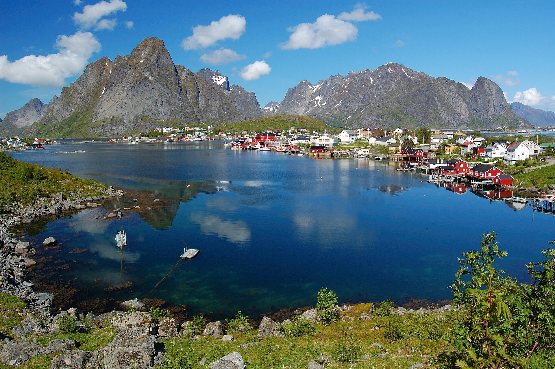
| Reinefjorden | Nordland | Reine, Lofoten | The most photographed view in northern Norway |
| Lyngenfjord | Troms | Tromsø | 82 km, the longest fjord in Troms, with the Lyngen Alps behind |
| Altafjord | Finnmark | Alta | Broad, open, aurora country |
These do not combine with the western fjords on a short trip. Tromsø to Bergen is a two-hour flight, and the rail network does not go north of Bodø at all. If both are on your list, you are flying, and you need at least ten days — see our ten-day Norway itinerary for how that decision costs out.
The Oslofjord is a different animal
It is called a fjord and it is not one, in the sense visitors mean. The western fjords are glacially overdeepened trenches with near-vertical walls and a shallow sill at the mouth. The Oslofjord is a broad drowned valley, low-sided, scattered with islands and summer cabins, more like a large estuary.
Every year people book a trip to Oslo expecting the photographs and find a pleasant sailing bay. It is a lovely piece of water and a good afternoon out. It is not what the posters show. If the fjords are your reason for coming, you must go west — the comparison is in which fjord to visit in Norway.
The other map: the National Scenic Routes
There is a second map of fjord Norway that almost no travel article uses, and it is more useful for route planning than the road atlas.
Statens vegvesen designates 18 National Scenic Routes — Nasjonale turistveger — totalling around 2,240 kilometres. These are ordinary public roads chosen for their scenery and fitted with architect-designed viewpoints, rest stops and service buildings. You do not pay to use them and they are not tourist attractions in themselves; they are the roads you were going to drive anyway, with somewhere to stop.
You will see the total quoted as 1,850 km or around 2,100 km elsewhere. The official figure is 2,240 km.
The reason they matter for orientation is that they trace exactly the routes worth driving. If you plot the fjord-country scenic routes on a map, you have a ready-made itinerary skeleton:
| Route | Length | Where it runs | Season |
|---|---|---|---|
| Ryfylke | Long, southern | Rogaland, above the Lysefjord | Mostly year-round |
| Hardanger | 158 km | Around the Hardangerfjord, past Vøringsfossen | Year-round |
| Aurlandsfjellet | Short, high | Aurland to Lærdal via Stegastein | Opened 1 June 2026 |
| Sognefjellet | High mountain | Lustrafjord to Jotunheimen | Opened 2 April 2026, night closures until late May |
| Gamle Strynefjellsvegen | Historic gravel | Between Nordfjord and Otta | Restricted hours, June to mid-August |
| Geiranger–Trollstigen | Two famous halves | Geiranger over Ørnevegen to Åndalsnes | Trollstigen opened 27 April 2026 |
| Atlanterhavsvegen | Short, coastal | Molde area, out on the skerries | Year-round |
| Senja | 90 km | Arctic, Troms | Year-round |
| Helgelandskysten | 433 km | Nordland coast, six ferries | Year-round |
The Aurlandsfjellet and Gamle Strynefjellsvegen entries are the ones to watch: both are genuine shortcuts in summer and simply do not exist for half the year. Sognefjellet opened unusually early in 2026, on 2 April, but ran with overnight closures from 20:00 to 08:00 until late May — which is exactly the kind of detail that turns a planned evening drive into a two-hour detour.
What each region actually looks like
Maps do not convey texture, and the four fjord regions look genuinely different from one another.
Rogaland and the Lysefjord is vertical and bare. Granite, thin soil, and cliffs that go straight up out of the water. Preikestolen and Kjerag are here because the rock is right for it. The Lysefjord guide covers it, and Stavanger is the base.
Hardanger is the soft one. South-facing slopes, orchards, cider farms, blossom in early May. It looks more like a very steep Alpine valley than the postcard fjord, and it is the only fjord region with real agriculture. See the Hardangerfjord guide.
Sogn is the deep one — 205 kilometres from Solund at the coast to Skjolden at the head, with the water 1,308 metres down. It runs from open islands at the mouth to glaciers and 2,000-metre peaks at the top. More variety than any other single fjord; the Sognefjord guide has the detail.
Sunnmøre and Geiranger is the dramatic one. Sharp alpine peaks, hanging valleys, waterfalls falling directly into the water. The Geirangerfjord is the headline, but the Hjørundfjord next door is steeper and almost empty.
If you are choosing where to point a whole trip rather than a day, our guide to the best places to visit in Norway ranks the regions by how many days each deserves.
Reading a fjord map: three rules
Rule one: find the ferries before you plan the days. Norwegian route planners include them but travel blogs rarely do. Every crossing is a scheduled service with a frequency, and outside summer that frequency can be twice a day.
Rule two: a fjord’s head is a destination, its mouth is usually not. The scenery concentrates where the fjord narrows and the walls close in, which is at the inland end. Flåm, Geiranger, Gudvangen and Odda are all at fjord heads. The mouths are open water and low islands.
Rule three: assume 60 km/h average on the west coast. Not because the roads are bad — they are excellent — but because of tunnels with speed limits, single-lane sections, hairpins and ferry waits. Any plan built on 90 km/h will fail by mid-afternoon.
The route mistakes to avoid
Do not plan Bergen and Stavanger as a day trip pair. Five hours and two ferries each way. They are both worth visiting; they are not neighbours.
Do not build a summer itinerary and travel it in May. Aurlandsfjellet opened on 1 June in 2026. Gamle Strynefjellsvegen runs on restricted hours through June. Trollstigen opened unusually early on 27 April this year, and that was the earliest ever. A route that relies on any of them is a July route.
Do not drive to Lofoten from the fjords. Oslo to Lofoten is around 1,195 kilometres and 16 hours of driving, and the equivalent from Bergen is worse. Fly to Bodø or Evenes and pick up a car there.
Do not assume the coastal ship is a shortcut. Hurtigruten calls at 34 ports over about 2,500 nautical miles, and the full Bergen–Kirkenes round trip takes twelve days. It is a wonderful way to travel and a terrible way to get somewhere quickly.
Do not trust a nearest-airport claim without checking it. The most-linked fjord map article on the internet puts Trollfjord’s nearest airport 400 kilometres from Trollfjord. Cross-check anything that determines a booking.
The map, in four regions
| Region | Base | Days to do it justice | Get there by |
|---|---|---|---|
| Ryfylke & Lysefjord (Rogaland) | Stavanger | 2–3 | Fly to SVG. No car strictly needed |
| Hardanger & Sogn (Vestland) | Bergen, Flåm or Balestrand | 4–6 | Fly to BGO, then train and boat |
| Nordfjord & Sunnmøre (Vestland / Møre) | Loen, Stryn or Ålesund | 3–5 | Fly to AES. Car strongly recommended |
| Arctic fjords (Nordland, Troms, Finnmark) | Svolvær, Tromsø or Alta | 4+ | Fly. Rail stops at Bodø |
Most first trips should pick one of the first three. Two of them needs about ten days; all four is a fortnight of travelling and not much looking, though the driving version is covered in our two-week Norway road trip.
Frequently asked questions
Where exactly are the fjords in Norway?
Along the west coast, concentrated between Stavanger and Åndalsnes — roughly 500 kilometres of coast holding around 200 fjords, in the counties of Rogaland, Vestland and Møre og Romsdal. There are also fjords in the north, in Nordland, Troms and Finnmark, and an entirely different sort of inlet around Oslo.
Which part of Norway has the most fjords?
Vestland, comfortably. It contains the Sognefjord, the Nærøyfjord, the Aurlandsfjord, the Hardangerfjord and Nordfjord — the highest concentration of famous ones anywhere in the country, all within reach of Bergen.
What county is the Sognefjord in?
Vestland. It was in Sogn og Fjordane until that county was merged out of existence on 1 January 2020, and a great many travel pages have not noticed.
Which airport is closest to the Norwegian fjords?
Bergen for the central fjords, Ålesund for Geiranger, Stavanger for the Lysefjord. Sogndal is the underrated one — fifty minutes from Oslo and it drops you in the middle of the Sognefjord.
How far is Bergen from the fjords?
Bergen is on a fjord, though not a spectacular one. The Hardangerfjord starts about an hour and a half away; Flåm and the Nærøyfjord are about two and a half hours; the Geirangerfjord is eight hours and a ferry. Full detail in the Bergen guide.
Are there fjords in northern Norway?
Many, and they are emptier. Lyngenfjord runs 82 kilometres and is the longest in Troms; Trollfjord in Nordland is the most dramatic short fjord in the country. They cannot realistically be combined with the western fjords on a trip of under ten days.
Is the Oslofjord a real fjord?
Geologically it is a drowned river valley rather than a glacially overdeepened trench, so it looks and behaves quite differently from the western fjords. The name is historical. It is worth seeing if you are in Oslo and not worth travelling for.
Why does driving between fjords take so long?
Ferries, fjord-head detours, seasonal mountain roads and tunnel speed limits. Assume an average of about 60 km/h on the west coast, add the ferry waits, and your plans will survive contact with the day.
How many fjords does Norway have?
More than a thousand named ones. You will see 1,190 quoted, which includes Svalbard, and there is no definitive national count — so “more than a thousand” is the honest answer. Around 200 of them are on the classic western stretch. Our main fjord guide covers the ones worth your time.
Photo credits
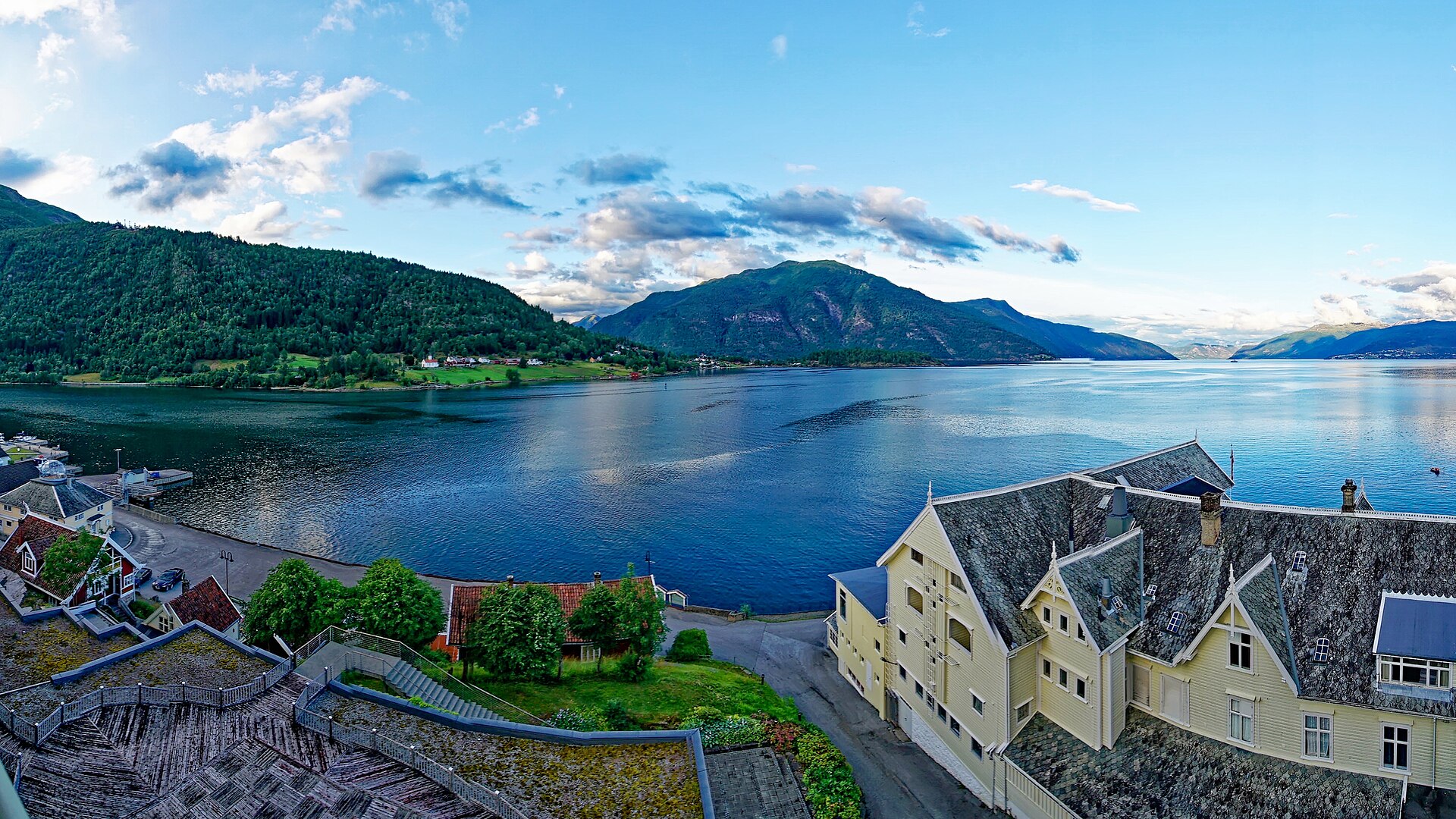
- The Sognefjord runs 205 kilometres from Solund to Skjolden and is 1,308 metres deep. — Photo: Holger Uwe Schmitt / CC BY-SA 4.0 via Wikimedia Commons.
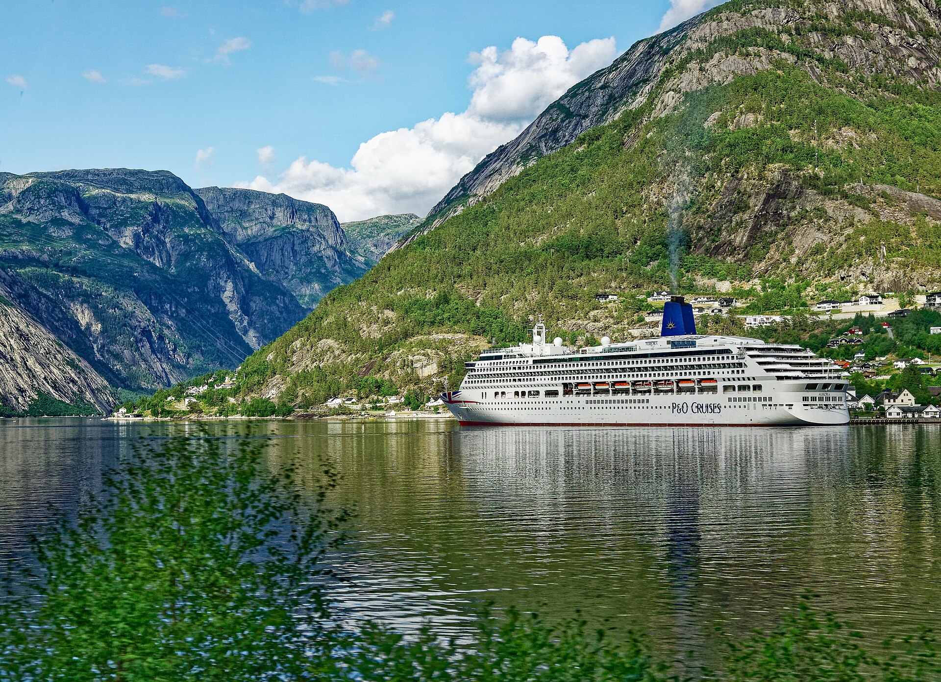
- The Hardangerfjord. Sources give its length as 179 or 190 kilometres, depending on where the mouth is drawn. — Photo: Holger Uwe Schmitt / CC BY-SA 4.0 via Wikimedia Commons.
- Reinefjorden, Nordland. The northern fjords are a different trip, and the railway does not reach them. — Photo: User:Sveter (Please credit as “Petr Šmerkl, Wikipedia” in case you use this outside WMF pr / CC BY-SA 3.0 via Wikimedia Commons.
County boundaries, tunnel projects and journey times checked 1 September 2026. Norwegian county structure changed in 2020 and again in January 2024, and older sources are unreliable on this. The Bergen Line’s length is given differently by the operator and by reference sources; both figures appear above. Rogfast is not expected before summer 2033.