Start with the thing nobody writing about the Oslofjord will tell you plainly: it is not a fjord. Not in the geological sense the word normally carries in Norway. Geirangerfjord and Nærøyfjord are glacier-carved troughs gouged out of rock. The Oslofjord sits in the Oslo Graben, a rift valley that pulled itself apart in the Permian, roughly 300 million years ago. Ice later scoured a pre-existing crack. It did not make one.
That is not pedantry, it is the reason the Oslofjord looks so different from the postcard fjords — broad, shallow, island-scattered and gentle, rather than a 1,000-metre wall of rock. Visitors who arrive expecting the west coast are disappointed, and they are disappointed because five different guides told them “fjord” and left it there.
The second thing nobody mentions is that the Oslofjord is in ecological trouble. The cod are effectively gone. There has been a fjord-wide fishing ban since the start of 2026. If you are going to swim in it, eat from it, or take a boat across it, that seems worth knowing.
Here is the honest version: the geology, the ferries with their actual line numbers and fares, the islands, when the water is warm enough to swim, and what is happening beneath it. For everything on dry land, see our Oslo sightseeing guide.
The facts, up front
| Question | Answer |
|---|---|
| Is it a true fjord? | No — it occupies the Permian-age Oslo Graben, a rift valley, not a glacially carved trough |
| Length | Sources disagree: commonly 100 km, but Wikipedia gives 120 km |
| Maximum depth | Around 258 m, though the Drøbak Sill at about 20 m is the number that matters |
| Cheapest way onto the water | A Ruter public ferry, on a normal transit ticket |
| Cost of a sightseeing cruise | 490–690 NOK (~$52–74) for 2.5 hours |
| Swimmable | Mid-June to August, 17–18°C average, up to 24°C in sheltered coves |
| Fishing | Fjord-wide cod ban running 2026–2035 |
Why the Drøbak Sill explains everything
The rest of the country’s fjords work the other way round — deep, narrow and sheer, as our guide to the Norwegian fjords explains. Halfway down the Oslofjord, at Drøbak, the seabed rises to a shallow ridge — the Drøbak Sill, around 20 metres deep, in a fjord that reaches 258 metres elsewhere. Everything about the inner Oslofjord follows from that ridge.
It restricts the exchange of water between the inner fjord and the open Skagerrak. Deep water in the inner basin renews slowly, sometimes not for years. Nutrients and warm summer surface water sit on top; oxygen down below runs out. That is the mechanism behind the fjord’s collapse, and it is also why the water at Sørenga is pleasantly warm in July when the North Sea is not.
The sill is also why Oscarsborg fortress sits where it does, and why on 9 April 1940 it was able to sink the German heavy cruiser Blücher at point-blank range in a channel barely wider than the ship. Narrow water is defensible water. It is the same 20-metre ridge.
Getting on the water without paying 690 kroner
Every guide sells a cruise. Brim Explorer’s silent electric boat runs 2.5 hours from Rådhusbrygge at 10:00 and 13:30, costing 690 NOK from April to December and 490 NOK from January to March. It is a genuinely nice boat and it is roughly sixteen times the price of the public alternative.
The public ferries are ordinary Ruter services on ordinary Ruter tickets. Nobody publishes the line numbers in one place, so here they are.
| Line | Route | Journey | When |
|---|---|---|---|
| B10 | Aker Brygge – Nesoddtangen | ~23 min, every 30 min | Year-round commuter service |
| B9 | Rådhusbrygge 3 – Bygdøy | ~8 min | Seasonal; bus 30 in winter |
| B1 | Hovedøya, Lindøya, Gressholmen, Bleikøya, Nakholmen | Circular | Year-round |
| B2–B4 | As above plus Langøyene | Circular | Summer only |
A caution on that table: the island line numbering comes from a single source I could not corroborate, and Ruter reorganises its boat lines more often than its metro lines. Check the pier board at Rådhusbrygge, which is reliable in a way that travel guides are not. What is not in doubt is that the boats leave from Rådhusbrygge by the City Hall and cost the price of a bus ride.
Verdict: take B10 to Nesoddtangen and straight back if you want the skyline, or the island circle if you want to get off and swim. The cruise is worth its price only for the narration, the heated cabin in February, or if someone else is paying.
The islands
Five inhabited or visitable islands sit within half an hour of the City Hall. They are Oslo’s best-kept ordinary secret — busy with locals on a July Sunday, near-empty midweek.
Hovedøya
The closest and the best first choice. Ruins of a Cistercian monastery founded in 1147, two beaches, a marked walking loop, and cannon batteries from the Napoleonic era. Free to land, free to walk. Allow two to three hours. If you are staying nearby, the harbour-front districts in our guide to where to stay in Oslo put you minutes from the pier.
Langøyene
The swimming island: two beaches on a sand spit, a campsite, and a naturist section at one end. Summer boats only. This is where Oslo goes on a hot Saturday, so go midweek if you want space.
Gressholmen and Rambergøya
Joined at low water, quieter than Hovedøya, good for a walk and a swim off the rocks. Oslo’s first airport was here, which is a strange thing to stand on.
Lindøya, Nakholmen and Bleikøya
Cabin islands — hundreds of small painted summer huts on leased plots, no hotels, no shops. You can land and walk the paths but you are walking through somebody’s weekend. Bleikøya is a nature reserve with landing restrictions in the bird nesting season.
Verdict on all of them: Hovedøya if you have three hours, Langøyene if you have come to swim, and skip the cabin islands unless you like looking at other people’s sheds. Which, honestly, I do.
East side or west side
Once you leave Oslo the fjord splits into two quite different shores, and every guide treats them as one place. They are not interchangeable.
| East side (Østfold) | West side (Vestfold) | |
|---|---|---|
| Main towns | Drøbak, Son, Moss, Fredrikstad, Halden | Horten, Åsgårdstrand, Tønsberg, Sandefjord, Larvik |
| Character | Fortresses, wooden towns, working harbours | Beaches, summer houses, Viking history |
| By train from Oslo | Moss ~40 min, Fredrikstad ~1 hr | Tønsberg ~1 hr 11 min |
| Best single stop | Drøbak and Oscarsborg | Tønsberg |
| National park | Ytre Hvaler | Færder |
The short recommendation: if you have one day, go east to Drøbak, because the fortress crossing is cheap, quick and genuinely interesting. If you have a car and two days, go west, because the coastline south of Tønsberg towards Verdens Ende is the better drive and the beaches are better. Doing both properly is a road trip rather than a day out, and that is covered in our southern Norway road trip guide.
Kayaking, sailing and small boats
The inner Oslofjord is unusually good paddling water — sheltered, shallow, dotted with islands close enough together that you are never far from land. Rental operators run from Aker Brygge, Sørenga and the islands themselves in summer. Prices vary widely enough between them that I am not going to print a single figure I would then have to defend; expect it to be a several-hundred-krone afternoon rather than a cheap one.
Two practical points. The fjord carries real commercial traffic, including the Nesoddtangen ferries running every thirty minutes and the Kiel and Frederikshavn ships heading out through the narrows, so a kayak in the main channel is a kayak in a shipping lane. And Norway’s right to roam — allemannsretten — extends to landing on and camping on uncultivated shore, which is why the islands have tents on them in July and nobody objects. Stay 150 metres from inhabited buildings and leave the site clean.
The fjord from land
You do not need a boat. Several of the best views of the Oslofjord are free and reachable on foot or by tram from central Oslo.
- The Opera House roof — the standard shot, four minutes from Oslo S, no ticket.
- Ekebergparken — the hillside east of the centre, tram 13 or 19. The view Munch painted The Scream from, looking down the length of the inner fjord.
- Akershus Fortress ramparts — free, open 06:00 to 21:00, straight out over the harbour.
- Huk, on Bygdøy — a beach with a view back at the city, bus 30 year-round.
- The Nesoddtangen side — get off the B10 ferry rather than riding it back and walk the shore path for the reverse view of the Oslo skyline. Almost nobody does this.
Between them that is a full day of fjord scenery for the price of a transit ticket, which is roughly what our guide to Norway’s best fjord viewpoints would cost you several hundred kroner for anywhere else in the country. The advantage of a capital city built on the water is that the good vantage points are public.
Swimming: when, and how cold
The Oslofjord is genuinely swimmable, which surprises people who assume Norway means cold water. The inner fjord’s shallow sill traps warm surface water in summer.
| Month | Typical water temp | Verdict |
|---|---|---|
| May | Cold | For the committed only |
| June | ~17°C | Swimmable from mid-month |
| July | ~18.3°C average, 15–24.3°C range | Comfortable; sheltered coves reach 23–24°C |
| August | ~17.8°C | The best month — warm water, longer than June |
| September | Falling | Early September still works on a warm day |
These figures come from one source that dominated every search I ran, so treat them as indicative rather than measured. The pattern is right even if the decimals are not.
Where to swim without leaving the city: Sørenga Sjøbad, the free seawater pool and decking at the end of the Bjørvika waterfront, open year-round. Also Tjuvholmen’s small city beach, Huk on Bygdøy, and the island beaches. All free. More of the same in our list of free things to do in Oslo.
The part the guides leave out: the fjord is in trouble
I have read a dozen articles about the Oslofjord and not one mentions this, which is remarkable given it is the most significant thing that has happened to this body of water in a century.
Cod catches in the Oslofjord fell from around 150 tonnes in 2000 to about 5 tonnes in 2024. Spawning biomass is down 80–90 per cent from its 2004 peak. The causes stack: agricultural run-off and sewage feeding algal blooms, the sill restricting deep-water renewal so oxygen never comes back, warming water, and decades of fishing pressure on a stock that could not take it.
A regulation running from 1 January 2026 to 31 December 2035 bans cod fishing across the fjord and adds three zero-fishing zones — the inner fjord, Færder and Hvaler. I could not confirm the exact terms against the Fiskeridirektoratet’s own pages, so if you intend to fish, check the current rules before you cast rather than trusting this paragraph.
What this means for a visitor is small but real. Sea-fishing trips out of Oslo are not the activity they were. Restaurants sourcing local cod are not sourcing it here. And when you swim off Hovedøya in August, you are swimming in a system that is being actively rescued, with oxygenation projects and run-off controls under way. It does not stop it being a lovely place to swim. It is just worth not being the tourist who does not know.
Beyond the city: the towns down the fjord
The Oslofjord runs 100 kilometres or so from the capital to the Skagerrak, and the towns along it are the easiest days out from Oslo.
Drøbak
A white wooden town at the narrows, about 40 minutes on bus 500 from the Oslo bus terminal with departures every half hour, or roughly 1.5 hours on a seasonal fjord ferry. From Drøbak, a five-minute boat crosses to Oscarsborg fortress for 70 NOK return — the island battery that sank the Blücher. That is the single best-value historic site anywhere near Oslo.
Tønsberg
Norway’s oldest town, about 1 hour 11 minutes by train from Oslo S. Viking history, a ruined castle on a hill, and the gateway to the Færder archipelago.
Horten and Åsgårdstrand
No direct train — change to a bus at Skoppum, around 2 hours 5 minutes total. Åsgårdstrand holds Munch’s summer house, open May and September at weekends 11:00–16:00 and June to August Tuesday to Sunday 11:00–17:00, at 50 NOK adult, 30 NOK concession, free under 17.
Fredrikstad
About an hour by train, with the best-preserved fortified old town in Scandinavia. Reachable and returnable in a day, and covered properly in our guide to day trips from Oslo.
The two national parks
Nobody writing about the Oslofjord names these, which is odd, because they are the reason the outer fjord is worth a night rather than a day.
Færder National Park, established 23 August 2013, covers 340 km² — 325 of sea and 15 of land — off Tønsberg. Bare coastal rock, low pine, and an archipelago you need a boat for.
Ytre Hvaler National Park, established 26 June 2009, covers 354 km² and was Norway’s first marine national park. The Tisler reef inside it is over 1,200 metres long and 200 wide — the largest known inshore cold-water coral reef in Europe, sitting in water most people assume is empty.
Verdict: both need a car or a boat and a full day minimum. They are not add-ons to an Oslo city break. If you have a week and a vehicle, Hvaler is the more interesting of the two.
What to skip
The 690-krone sightseeing cruise, in most cases. The B10 public ferry crosses the same water for a normal fare. Pay for the cruise if you want commentary or a warm cabin in winter; otherwise you are buying a seat.
Expecting west-coast scenery. This is the biggest single mismatch between expectation and reality on this fjord. There are no 1,000-metre cliffs, no Seven Sisters waterfall, no Trolltunga. The Oslofjord is broad, low and green. If you came to Norway for the vertical drama, that is on the west coast — start with our guide to Norway’s best fjords or the piece on which fjord to visit.
Winter island trips. The summer island lines do not run, the cabin islands are shuttered, and the beaches are rock in the rain. The B10 crossing still works and still gives you the skyline.
Waiting for it to freeze. It generally does not. Only sheltered inner sections such as Bunnefjorden ice over in a properly cold winter, and the police warn people off the ice when they do.
Fishing, for the moment. Cod are banned fjord-wide until 2035 and there are zero-fishing zones. Check the current regulations rather than assuming a hotel-desk answer is up to date.
A day on the fjord, planned
- 09:30 Rådhusbrygge, by the City Hall. Island boat to Hovedøya. Normal transit fare.
- 09:45 Walk the monastery ruins and the coastal loop. Swim if it is July or August.
- 12:30 Boat on to Gressholmen or back to the city.
- 13:30 Lunch on the Sørenga decking, bought from a supermarket. Free swimming pool alongside.
- 15:00 B10 from Aker Brygge to Nesoddtangen and straight back — 46 minutes of skyline for one fare.
- 16:30 Opera House roof for the view back over the water you have just been on.
Total transport cost: one 24-hour Ruter ticket, quoted between 105 and 137 NOK depending on the source. That is your whole day on the water. The timed city version is in one day in Oslo, and the wider geological story is in how Norway’s fjords were formed.
Frequently asked questions
Is the Oslofjord a real fjord?
Not in the geological sense. It occupies the Oslo Graben, a rift valley that formed in the Permian around 300 million years ago; glaciers later deepened an existing crack rather than carving a new trough. That is why it looks nothing like Geirangerfjord.
How long is the Oslofjord?
Sources disagree. The commonly quoted figure is 100 kilometres, while Wikipedia gives 120. Both appear in print regularly and I have not found a definitive resolution, so treat “roughly 100–120 km” as the honest answer.
How deep is the Oslofjord?
Around 258 metres at its deepest, but the Drøbak Sill at about 20 metres is the more important number — it restricts water exchange with the open sea and drives most of the fjord’s ecology.
Can you swim in the Oslofjord?
Yes, from mid-June to August. July averages about 18°C with sheltered coves reaching 23–24°C. Sørenga Sjøbad in central Oslo is free and open year-round.
How do you get to the Oslofjord islands from Oslo?
Ruter public ferries leave from Rådhusbrygge next to the City Hall on ordinary transit tickets. Hovedøya, Lindøya, Gressholmen, Bleikøya and Nakholmen are served year-round; Langøyene is summer only.
How much does an Oslofjord cruise cost?
Around 690 NOK for a 2.5-hour cruise from April to December, 490 NOK from January to March. The public ferry across to Nesoddtangen costs a normal transit fare and takes 23 minutes each way.
What happened to the cod in the Oslofjord?
Catches collapsed from around 150 tonnes in 2000 to about 5 tonnes in 2024, with spawning biomass down 80–90 per cent from its 2004 peak. Run-off, oxygen depletion behind the Drøbak Sill, warming and fishing pressure all contributed. A fjord-wide cod ban runs from 2026 to 2035.
Is the Oslofjord worth visiting?
As a way of getting onto the water cheaply from a capital city, yes — few cities offer public ferries to swimmable islands. As a substitute for the western fjords, no. They are different landforms and it shows.
Photo credits
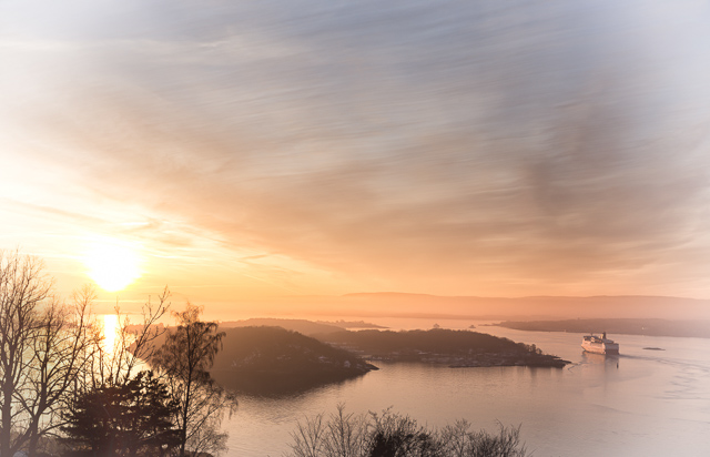
- Hovedoya: monastery ruins, two beaches and a walking loop, on a normal transit ticket. — Photo: Tore Sætre / CC BY-SA 4.0 via Wikimedia Commons.
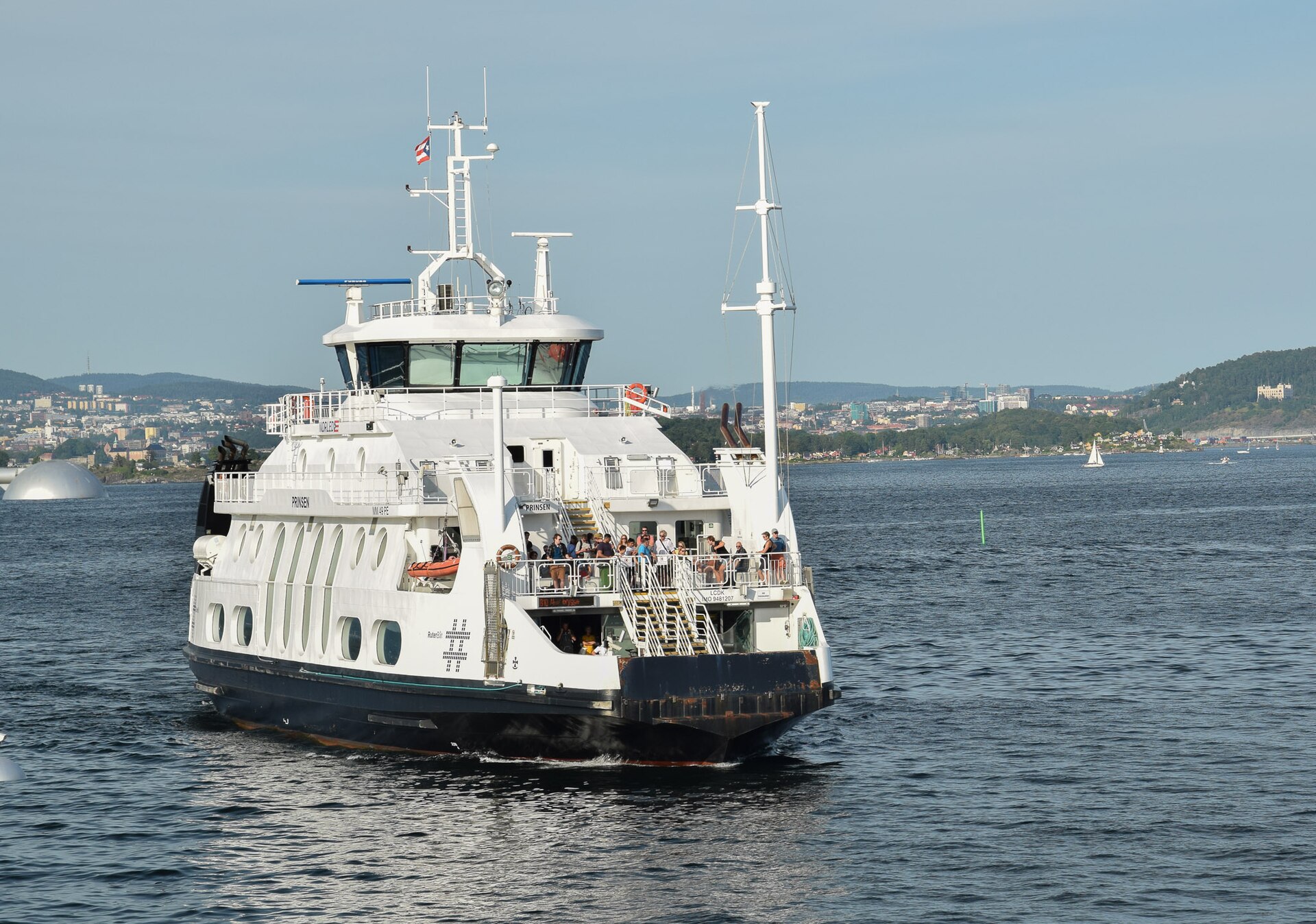
- The B10 to Nesoddtangen: 23 minutes each way, every half hour, for the price of a bus ride. — Photo: Helge Høifødt / CC BY-SA 4.0 via Wikimedia Commons.
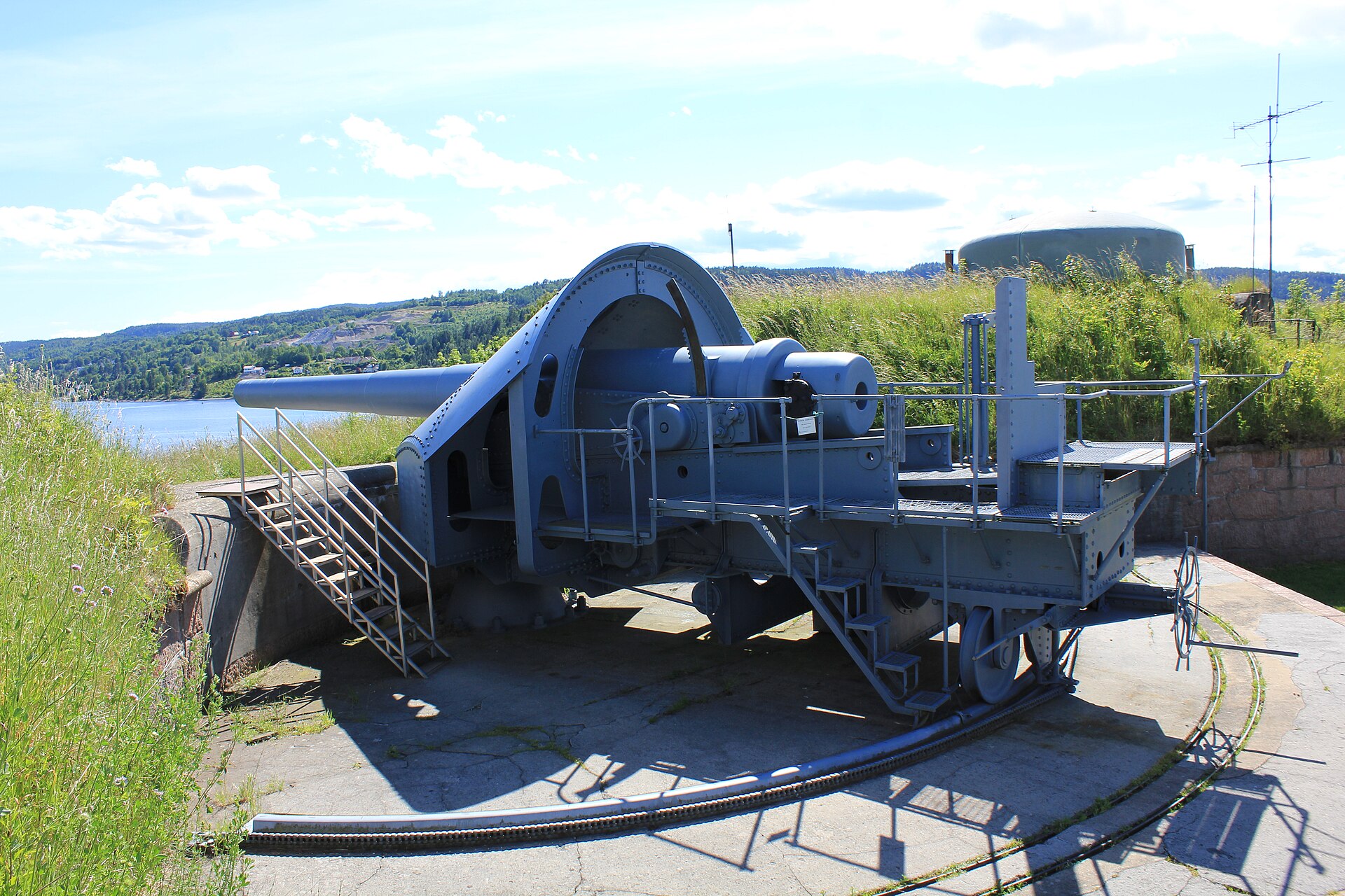
- Oscarsborg, at the Drobak narrows, where the Blucher was sunk in April 1940. — Photo: Øyvind Holmstad / CC BY-SA 3.0 via Wikimedia Commons.
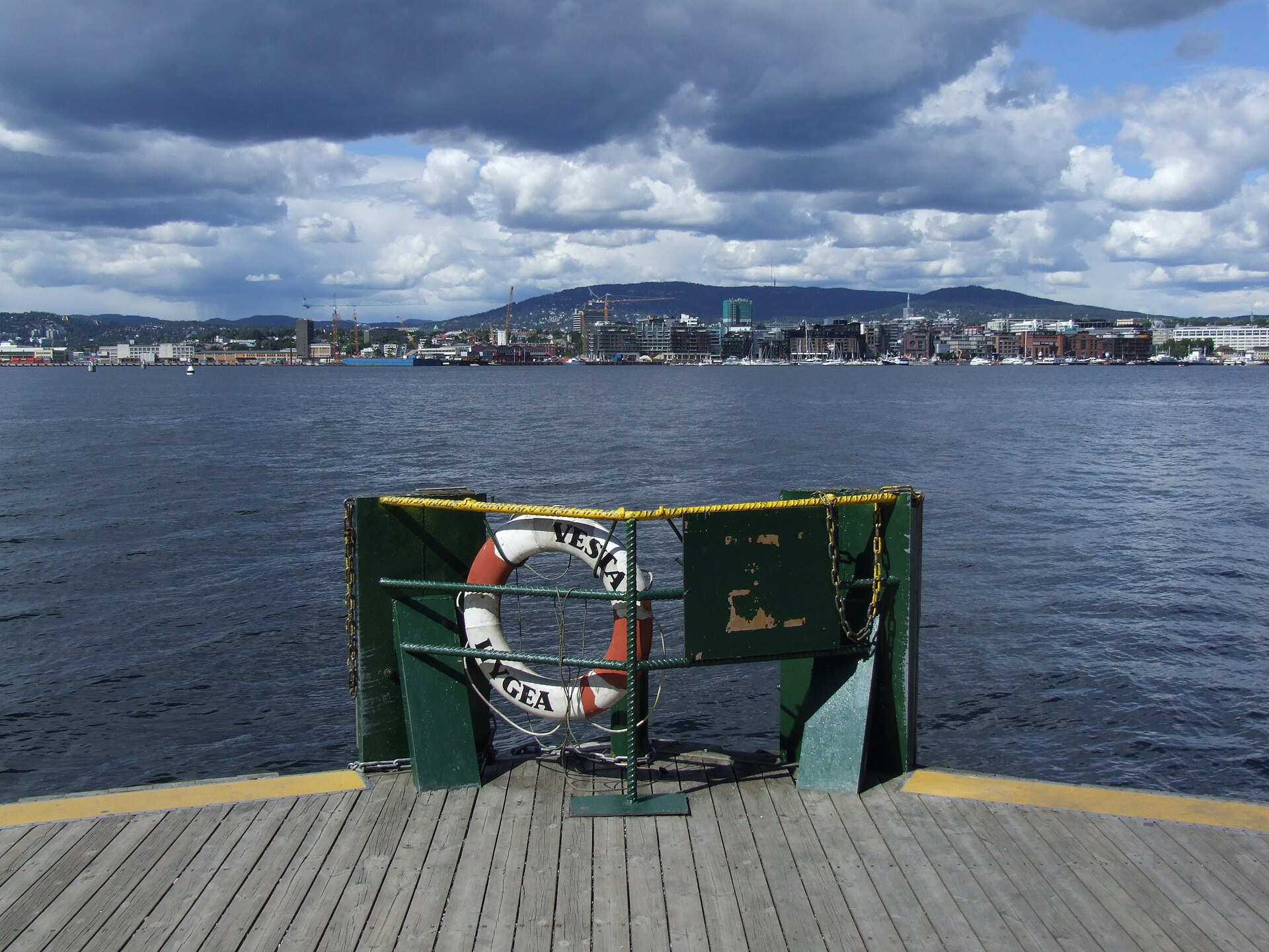
- The reverse view: get off the ferry and look back. Almost no visitor does this. — Photo: Pudelek (Marcin Szala) / CC BY-SA 4.0 via Wikimedia Commons.
Prices checked August 2026 and converted at 9.35 NOK to 1 USD. Ruter boat line numbers and summer schedules change between seasons — the pier board at Rådhusbrygge is more reliable than any published guide, including this one. The 2026 fishing regulations are summarised from secondary reporting; confirm with Fiskeridirektoratet before fishing. Where sources disagreed on the fjord’s length and on water temperatures, I have given the disagreement rather than picking a side.